This is my three-minute thesis talk. I have tried to condense the big idea of my research into three minutes.

All in Land Use/Land Cover
This is my three-minute thesis talk. I have tried to condense the big idea of my research into three minutes.
Cran blog about cran bogs. Cranberries are a delicious superfruit that is native to the amazing New Jersey Pine Barrens. Botany, Ecology, cuisine, oh my!
Results! These are some results that I recently shared at the Student Conference on Conservation Science in New York. I have summarized the talk I gave there in which I reveal the plant species that I found in detention basins in my 2018 study. In some of my earlier posts, I described the background of the project that I am working on. This one will catch you up on the background, but also give some answers.
I am working on mapping sites to recognize patterns on the land between plants and stormwater. Object-based analysis is an approach to classification that uses the color of groups of pixels rather than single pixels and adds spatial information to the spectral information. The output of object-based image analysis is accurate categories of fine-scale objects and landscape types along with relationships between them.
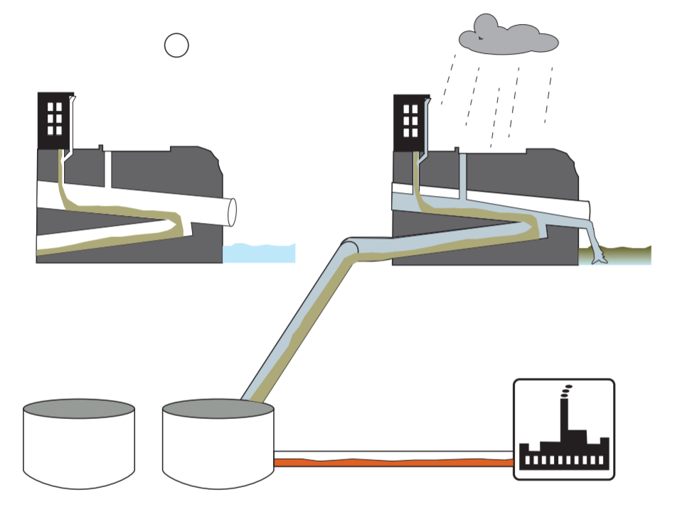
There are over 16,000 stormwater basins in all of New Jersey (https://hydro.rutgers.edu/). Locally, there are over 1500 detention basins in the Lower Raritan Watershed. Enhancing the functions of these basins represents a large-scale opportunity to restore environmental quality. When detention basins are lined with native plants, the thicker vegetation can trap contaminants and prevent them from running into streams and drinking water sources.
Here I introduce the system that I am working in, the problem that I have identified, and my research agenda. Though stormwater, and the systems designed to contain it, are part of our everyday landscapes, we usually don’t notice them. As flooding and pollution from storms worsen, stormwater and its systems deserve our attention.